Showing posts with label pa hiking. Show all posts

Monday, January 23, 2017

What will you do today?

What will you do today, that you will be grateful for in six months (or a year)?

It may be one small thing, going for a run, or a workout at the gym, making a better nutrition choice, being mindful, paying attention to your spouse, significant other or kids, making the doctors appointment, connecting with friends, saving instead of spending... whatever it is, pick one thing and do it, just for today.

Tuesday, January 10, 2017

Lower rhymes with flower

The Lower Trail is a 16.5  mile rail-trail along the Frankstown Branch of the Juniata River.

A Rail Trail, is an old railroad that has been re-purposed as a multi-use trail. In more hospitable weather you can find people walking, running, riding bikes and riding horses along the trail. Since trains require flat, wide, tracks, converted railroads tend to be very easy to hike. Typically, you won't find steep grades or rocky terrain. Rather wide paths of crushed gravel or grass, with gentle slopes are the norm.

On a cold  (10°F) Saturday morning in January, we pulled into the Alfarata Station trailhead parking area. This is also the northern terminus of the Lower Trail.  There is plenty of parking and a pit toilet, as well as signs and benches. Due to the extremely cold weather and the possibility for snow and ice on the ground, a rail trail made perfect sense, for my second hike of the year.

The only downside, at least with this path, is that there really aren't any side trails for doing loops. Straight out and backs, or point to point is your only option.

There are however, a number of Boy Scout Eagle projects along the path, including benches, beacons, bird houses and educational signage about the history and ecology of the trail. These make the extremely non-technical trail very informative and entertaining.

Trails near water tend to be great for spotting birds and this one never disappoints. We saw ducks, Bluejays, and a woodpecker. I also tagged cardinals and a red tailed hawk on the way home.

Monday, December 5, 2016

Tussey ridge and John Wert path - nice trails, and cairn hiking all in one

About a 7.5 mile loop of classic central PA hiking.

Start from the parking area at Bear Meadows Natural Area. Hike north, either along the road, or take the Jean Aron Path towards North Meadows Road.

Across from the North Meadows Road parking area (alternate parking here), look for the the red blazed Tussey Mountain Trail. This is a multiuse trail, so keep an eye out for mountain bikers. It is a fairly gentle and smooth climb to the top of Treaster Kettle.  You will follow the ridge top for a couple miles, passing the intersection with the Kettle Trail. As you are hiking along the ridge top, you will get a couple glimpses of State College through Galbraith Gap to your left. Scenic Bechtol Gap to your right (east) leads to Colyer Lake.  

This is a fairly unusual ridge in that it is extremely narrow, bordering on knife-like  (at least by local standards).  You will also hike through a recovering forest fire area. This ridge suffered a wildfire in 2006, and even 11 years later (at the time of this writing) you can still find charred logs and dead trees. Evidence of how very permanent man's impact on wild areas can be.

At the time that I hiked this, the sign for Shingle Path was missing, but the post was there, and it's an obvious trail down to the right. This is a hiking only trail, as it is extremely steep with moments of hanging on to rocks and roots along the decent. As you reach the bottom of the mountain, the trail seems to dead end in a clearing, although some casting about in a more or less straight line down should bring you to the last few blazes and Treaster-Kettle Road. If you turn right here, you can road walk back to your car. Alternatively, you can continue across the road on Shingle Path, and up the next ridge (Little Mountain), although we will only be going to the bench, and not all the way to the next ridge top. Shingle Path is clearly a hiking path here as well, as the trail has been pretty effectively blocked with ditches and piles of rubble. Carefully work your way through this obstacle course, and you will shortly be back on a nice trail. Eventually you will reach a gas pipeline. Our trail continues across, but you can cut the corner by turning right and staying on the pipeline and catching the John Wert Path in a bit.

Shingle Path from this point becomes very unique, as there are no longer blazes, but the trail is marked by cairns (rock piles) as you continue up the hill. Feel free to add a rock to each cairn in thanks as you pass by.  Eventually you will reach the top of Little Mountain (really a bench below Thickhead Mountain) and descend briefly to Sinking  Creek. The trail appears to dead end into a cabin's parking area, turn right here and pick up the John Wert Path. You are once again on a multiuse path, so watch out for motor vehicles prior to passing the gate, and for mountain bikes at any point from here back to your car.

Follow the wide, well marked trail about two miles, very gradually uphill and back to Bear Meadows Road. When you reach the road, turn right and you will see your vehicle.

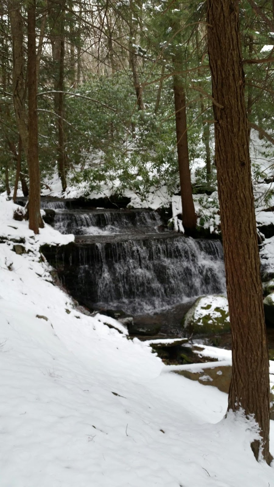
Like many of my ridge walks, this is lovely in the fall and spring when the leaves are down and you can get better views. The last couple miles take you along the Sinking Creek and are very picturesque. Shingle Path is a classic central PA trail in that it descends straight down a mountain, and straight up the next one. In addition, the opportunity to cairn hike, is pretty unique in the area and something to try out, if you've never had an opportunity to do so.


Monday, November 21, 2016

Grass Mountain

Fall is such a lovely time to go for a hike, and if you're looking for a nice reward, without too much effort Grass Mountain fits the bill.

This is a shuttle hike, which made it ideal since I had a partner with a car hiking with me. We parked her car at Alan Seeger Natural Area and then drove my car to Penn Roosevelt State Park.

Park in the day use area of Penn Roosevelt and head uphill past the 4-H camp on Thickhead Mountain Road, a gravel road. After a bit you will pass a gate and continue on Thickhead Mountain Road, which is a forest road/jeep trail at this point. Have fun going up and over the "moguls", as she called them. They're actually runoff control for when it rains excessively, to keep the road from washing out.

The road makes a wide u-turn and at the point of the "U", look for Long Mountain Trail on your left heading uphill. (Red blazed)

This trail heads up the steep eastern end of Grass Mountain. It is a bit of a climb so take your time. The reward is that when you attain the top, you will cross a wide, grassy, gas pipeline. On the far side of the pipeline follow a short side trail 100 yards to a campfire circle and gorgeous view of Slate Ridge to the south.

After you've enjoyed the view, return to the red blazed trail and continue west along the spine of Grass Mountain. You will gently descend along a grassy jeep trail that is used to access the pipeline for inspection and maintenance. Be careful as you reach the lower end of the trail, it is part of a Penn State research area and many of the trees are blazed in a variety of colors. These are to code them for the researchers, and not additional trails to follow.  

This trail forms the southern boundary of Thickhead Wild Area. According to the DCNR website, "...these 4,886 acres provide an extensive, undeveloped area of mixed-oak forest. Thickhead Mountain Wild Area surrounds the Detweiler Run and Bear Meadows Natural Areas."

Staying on the trail, you will come to the gated junction with Stone Creek Road. Turn right and walk along the road to return to your car.

4.6 miles

689 ft. total elevation gain
2 hours 40 minutes 


Monday, October 31, 2016

Eagle Trail Loop

This one is a little tricky, as it involves hiking through private property. However, if you are a Boy Scout, you're in luck! If not, contact the Juniata Valley Council of Boy Scouts of America to request permission to hike on their property. (Seven Mountains Scout Camp)

After getting permission to hike on BSA property, park in the parking area and proceed towards Eagle Lodge. The Eagle Trail will be on your right shortly after you pass the fire circle and Firelight Pavilion.

Since we were camping at Seven Mountains Scout Camp, we started from Rhodes campsite and hiked across the dam and up the short hill through Staff City. At the access road to Eagle Lodge we turned right and went about halfway to the fire circle. Look for the sign for Eagle Trail on your left (south). The trail is blazed yellow (and changes to blue as you approach the top of the mountain). After a brief meander the trail heads pretty much straight up the side of the mountain. You will pass between two deer exclusion areas connected by a forest road when you are about halfway up.

Continue across the grassy road and up the mountain. From here Eagle Trail takes on more of the character of the Mid-state Trail which you are about the meet. Not only is it all rocks, it's straight up. Take all the breaks you need, this is a tough trail.

At the crest of the mountain you will "T" into the Mid-state Trail. There's a trail sign at the intersection.

While there aren't any official vistas along this section of the trail, if you hike in late fall or early spring, when the leaves are off the trees, you can still get some pretty decent views.

Turn east  (hikers left) and continue to rock hop along the Mid-state Trail for about 10 minutes. You will then reach "the drop off". The trail appears to drop off into  Stillhouse Hollow.  It is indeed a steep and rocky descent.  Watch carefully for switchbacks.

After about a half an hour you will reach Stillhouse Hollow Road. Leave the trail here and turn north (hikers left) to follow Stillhouse Hollow Road. Watch for red and blue blazes on your left. These are the Nature trail. There are two sets of these blazes, the first set will take you past the chapel and back to the dam. The second set will take you back to the Nature Lodge and Rhoades campsite. If the numbered trail markers are ascending, you are headed back to the dam. If they are descending, then you are headed to the Nature Lodge.

The entire loop took us about 90 minutes, and is probably about 3 miles, although I forgot my GPS, so I'll have to do it again to get more accurate trail data.

Monday, April 11, 2016

Yost Run Trail Loop - Chuck Keiper Trail

This trail is not for the faint of heart. It is extremely technical.

This trail was relocated from the valley floor with multiple stream crossings to "side hill construction" in 2014. While your boots may stay drier, there are still a couple stream crossings to navigate mostly just rock hops during low water.

Side hill construction. .. so imagine a path about 6 inches wide, 30 to 50 feet above Yost Run.  The drop is fairly sheer in most places. As this is Pennsylvania the path is composed of rocks at varying orientations to horizontal and with varying levels of stability.  Now add 2 to 12 inches of loose leaf litter, so you can't tell when you're foot will hit solid (or not) ground.

"Don't look down" was my mantra for about 4 miles. As I inched my way along I was moving so slowly that my GPS recorded no movement.

This is a wild and beautiful trail in Sproul State forest. Definitely remote, most of the trail is also part of the Chuck Keiper Trail.

I noticed 2 established campsites. They are very remote, with good access to water. However, there is only room for one or two tents in the immediate area.

As you can see from the picture there was still snow on the ground when I did this hike. This led to an interesting phenomenon. Starting at about 3.5 miles, I saw "tracks" across the trail, like something slid down the hill. Shortly afterwards I started seeing balls of snow about as big as my head on the trail. The tracks ended in these balls of snow. Apparently, the snow was rolling off the rock ledges above me and gathering more snow at it rolled downhill, (think of how you make a snowman). I had never seen that in nature before. 

Others have written about the trail being overgrown in places. While that wasn't an issue for me this early on the season, I could definitely see some areas where the trail will be overgrown once the underbrush leafs out. The trail was fairly well blazed, I only lost the trail once and that was because I was following my feet instead of the blazes

To summarize, this is a very difficult trail, do not attempt unless you are in good physical condition. It will challenge your knees, ankles and core stability. Plan at least 5 hours to do the 7.5 mile loop. Wear boots with excellent ankle support and water resistance. There is no cell service and no bail out trails, if you get in trouble, you will have to get yourself out.

This lovely waterfall is the highlight of the trail and is located about 1.3 miles from the parking area.